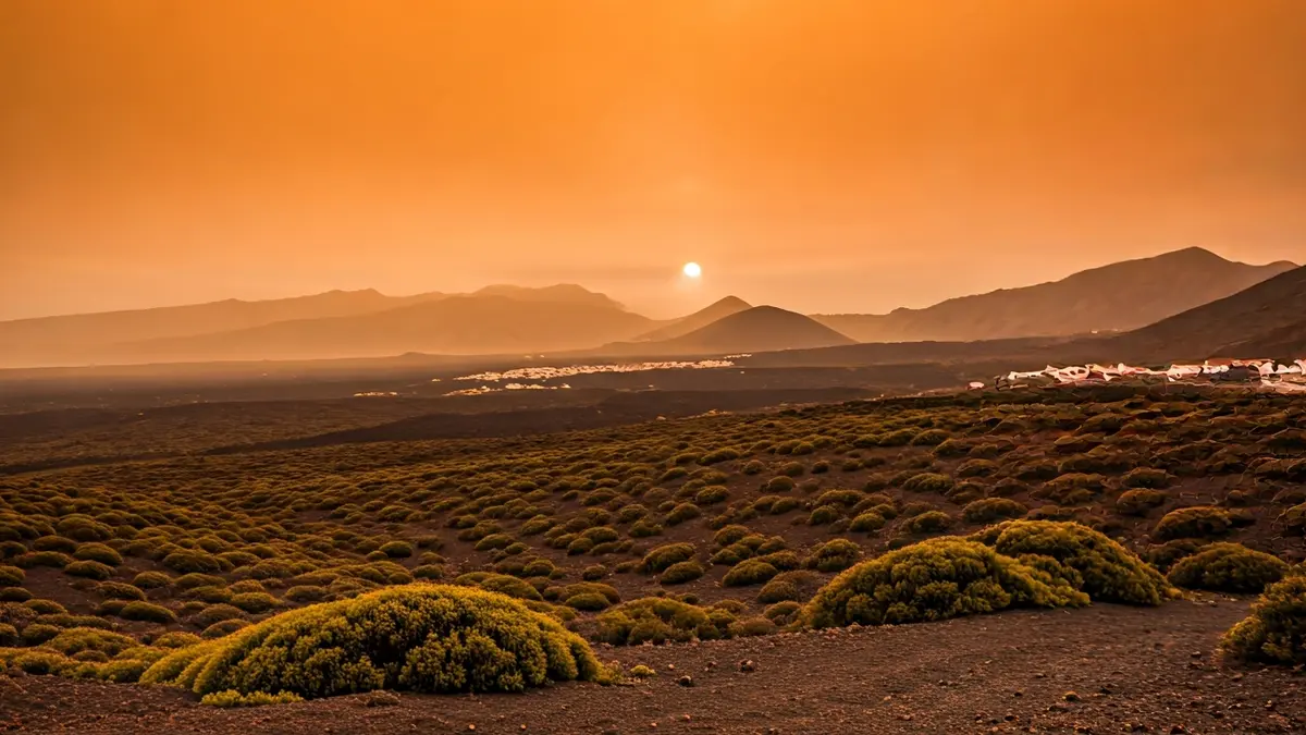
The influx of Saharan air will lead to a notable reduction in visibility, particularly in the higher elevations of the islands. This phenomenon, known as calima, will primarily affect the peaks of Gran Canaria, where visibility could drop to 3,000 meters.
The warning for suspended dust will come into effect at 12:00 PM on Saturday, April 18, and will remain active throughout the day. The calima is expected to be particularly intense on Saturday and Sunday, also extending to the mid-altitudes of the islands in both the eastern and western provinces.
Concurrently, temperatures will experience a gradual increase. Starting from Friday, April 17, thermometers could already exceed 30 ºC in inland Fuerteventura and the mid-altitudes of southern Gran Canaria. However, the peak heat is anticipated for Saturday and Sunday.
On April 18, temperatures will rise from slight to moderate, surpassing 30 ºC in southern Gran Canaria and Tenerife. In some inland areas of Fuerteventura and the mid-altitudes of southern Gran Canaria, maximums could locally reach 34 ºC. By Sunday, April 20, the upward trend will continue, with temperatures likely to reach 34 ºC on the southern slopes of Tenerife and Gran Canaria, as well as in the eastern islands. Provincial capitals will also reflect this increase, with forecast maximums of 28 ºC in Las Palmas de Gran Canaria and up to 31 ºC in Santa Cruz de Tenerife.
This episode of calima and high temperatures will define the meteorological dynamics for the coming days, with an atmosphere dominated by stability and the influx of suspended particles across the entire island territory.